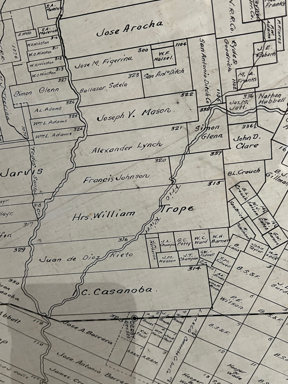
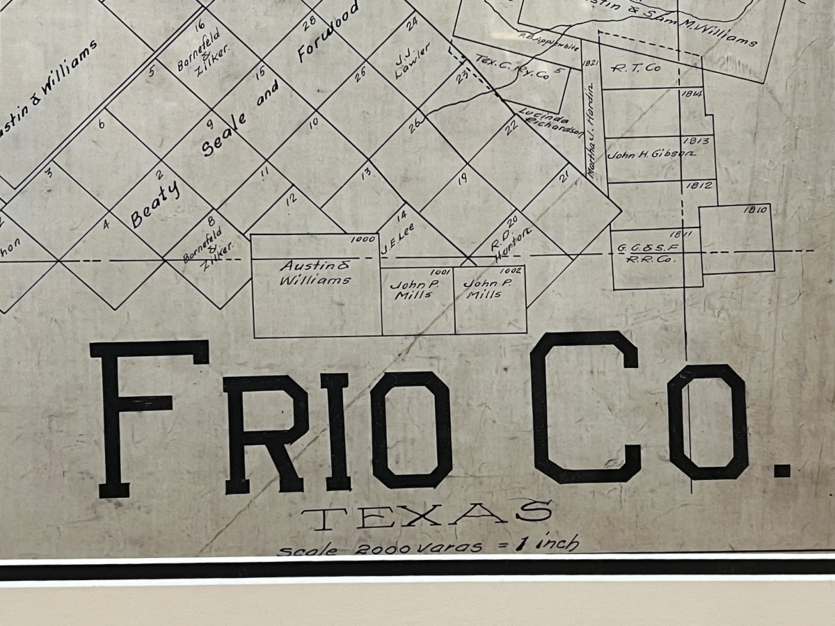
Texas County Maps 1870s-1910 "Frio County" Texas County Map
- Texas County Maps 1870s-1910
- Made in Houston Texas in the 1870s-1910
- Image Size: 37 x 40
- Frame Size: 42 x 46
- Medium: Original Hand Drawn Ink
- "Frio County" Texas County Map
- Contact for Price & Info
- View All By This Artist
Biography
Texas County Maps 1870s-1910
Early original hand drawn Texas County Maps (1870s-1910)
About 50 years ago or so, a close friend of mine attended an estate sale of a "landman" or possible executive of the Rock Oil Company in Houston. I don't think that company is the same Rock Oil Co. that is in business today. While there, my friend acquired a group of over 200 Early Texas County Maps. The majority of the maps are marked "The Rock Oil Co." or "The Rock Map Co." There were several that were made by other map companies in Austin. These are all original, hand drawn with ink. The maps were drawn on some sort of fibrous somewhat "waxy" paper, most likely Vellum. They were all rolled when my friend found them. 90% of our remaining inventory is still rolled. We unroll a few at a time as we sell others. We have to flatten them out on our hot table to get them as flat as possible. We then frame them with all conservation matting, backing and glass. Let us know your wants. You can see a handful on my website, but we have a detailed inventory list of the other counties that are still available.
Many of these maps were originally surveyed for the railroads after the Civil War. The State of Texas traded the various railroad companies alternating tracts in each county in exchange for their commitment to bring rail tracks through each state. The transactions were motivated by the need to develop transportation for farm and ranch production to market. When the railroads ended up owning all the rural land, they consequently owned substantial mineral rights. The Texas Railroad Commission was established to regulate the railroads and subsequently it regulated the oil and gas business since the railroad companies owned all the minerals. The Railroad Commission still regulates the energy business in Texas.
These are historical and fun. We have sold many to folks that may have minerals or ranches or family history from particular counties.